HomeThe heritage walk
Cabbagetown walking tour: a self-guided heritage walk through the Victorian streets
The Cabbagetown heritage walk in ten stops: about three and a half kilometres, almost all of it on quiet side streets. The route starts at the glasshouses of Allan Gardens, crosses Parliament Street into the rows, drops to the valley edge at Riverdale Farm and finishes among the graves of St. James Cemetery.

The walk · 10 stops · about 3.5 km
The route, one stop at a time
Scroll through the ten stops in walking order. The lamp on the plan marks where each slide stands, and every stop links to its fuller page in this guide.
Plan drawn from OpenStreetMap data (© OpenStreetMap contributors), rotated so the street grid stands upright. The route follows public sidewalks and park paths.
-
1Carlton St at Sherbourne St · just west
Allan Gardens
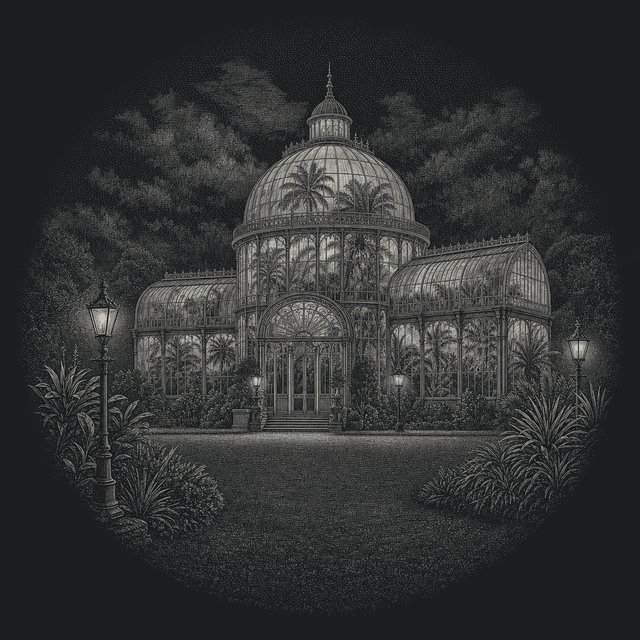
One of the oldest parks in Toronto, a short walk west of Cabbagetown. The Palm House and its sixteen-sided glass dome were designed by city architect Robert McCallum and opened in 1910, after a fire in 1902 destroyed the pavilion that stood here before. Allan Gardens guide
-
2Parliament St at Carlton St
Parliament Street
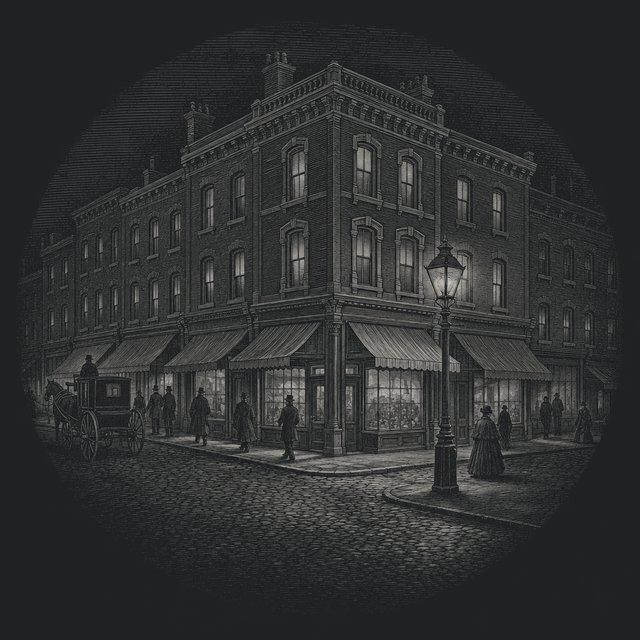
The western edge of the neighbourhood and its high street, which the Cabbagetown Preservation Association calls the heart of Cabbagetown. Shops, cafés and restaurants line both sides; the residential streets start as soon as you turn east. Eating on Parliament Street
-
3Carlton St at Sackville St
Carlton Street
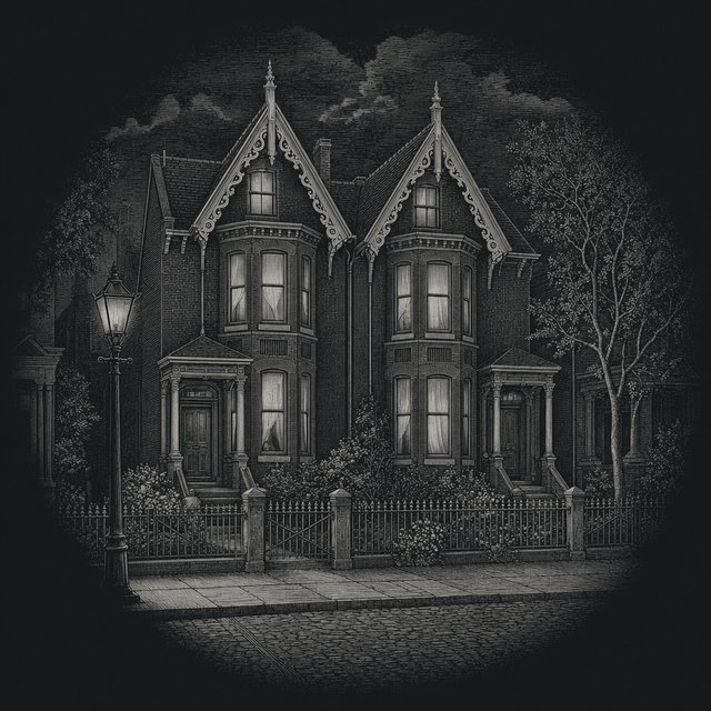
East of Parliament, Carlton carries some of the larger houses in the area, built for the owners of local businesses. Most of the houses in Cabbagetown went up in the 1880s and 1890s, and the bay-and-gable front is the one you will see most. Tell the house styles apart
-
4Spruce St at Sumach St
Spruce Court
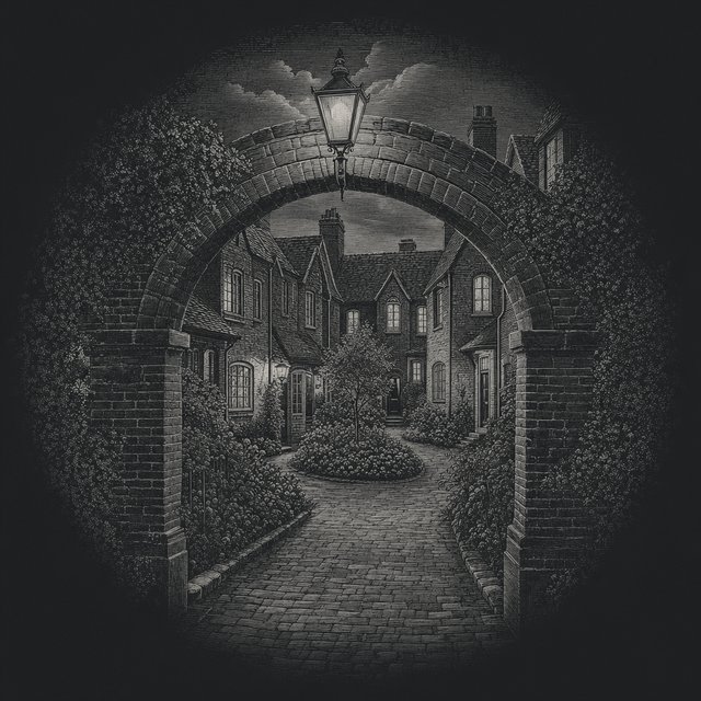
Begun in 1913 by the Toronto Housing Company to plans by Eden Smith, Spruce Court is one of the earliest examples of publicly supported rental housing in Canada. Cottage flats and townhouses face grassed courtyards. It is a housing co-operative and private, so look from the street. Cabbagetown history
-
5Carlton St at the valley edge
Riverdale Park West
Where the side streets end, the ground drops into the Don Valley. Riverdale Park opened for public recreation in 1880 on both sides of the river, and the west slope has long been a toboggan hill in winter. Riverdale Park guide
-
6201 Winchester St
Riverdale Farm
A working farm run by the City, opened on 9 September 1978 on the grounds of the Riverdale Zoo, which operated here from 1894 to 1974. Its oldest building, the Francey Barn, dates from 1858 and was moved here from Markham Township. Entry is free. Riverdale Farm guide
-
7200 Winchester St
Toronto Necropolis
A cemetery on the rim of the valley, established in 1850. Its chapel, lodge and porte-cochère were built in 1872 to designs by Henry Langley. William Lyon Mackenzie, the first mayor of Toronto, and George Brown, a Father of Confederation, are buried here. The two cemeteries
-
8Metcalfe St, Carlton to Winchester
Metcalfe Street
Two blocks and about sixty houses, many behind iron fences. Metcalfe became the first of the heritage conservation districts in Cabbagetown when City Council designated the Cabbagetown-Metcalfe district in 2002. The heritage districts
-
9off Wellesley St E
Wellesley Cottages
A short lane of one-storey workers’ cottages built in 1886–87, each with a steep gable facing the street. The lane is a private street kept up by its residents, so view it from the entrance on Wellesley Street East. The workers’ cottage
-
10635 Parliament St
St. James Cemetery
Opened in 1844 and still in use, the oldest operating cemetery in Toronto. Just inside the gates stands the Chapel of St. James-the-Less, built in 1861 to designs by Cumberland and Storm and a National Historic Site since 1990. The two cemeteries
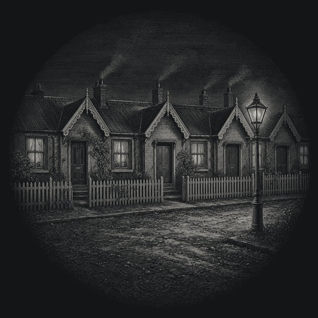
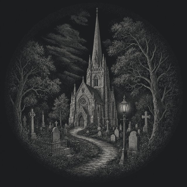
The Cabbagetown walking tour on this page, a heritage walk of ten stops, follows the rows of the neighbourhood and the green edge around it. Think of it as the Cabbagetown heritage walk for anyone without a guide. Every stop has an address, a short account of what stands there and a note on what to look for. The same route appears on the walk map, which works on a phone, and on a printable walk sheet for carrying on paper.
Nothing on the route needs a ticket. The houses are private, so the walk keeps to sidewalks, park paths and the public drives of the two cemeteries.
Before you set out on the Cabbagetown walking tour
The route measures about 3.5 kilometres. That figure comes from the street plan used on this site, which is drawn from OpenStreetMap data and measured segment by segment along the line of the walk, so treat it as a close estimate and not a surveyed distance. At a steady pace the walking alone takes around 45 minutes. Most people take two hours, because the farm and the cemeteries are not places to hurry through.
Start at Allan Gardens on Carlton Street, a short block west of Sherbourne. The 506 Carlton streetcar stops close by. The walk finishes at the gates of St. James Cemetery on Parliament Street, north of Wellesley, and from there it is about a kilometre back down Parliament to Carlton, past the cafés and restaurants of the neighbourhood’s main street.
Wear shoes with grip if it has rained. The side streets are flat, but the paths at the valley edge, in Riverdale Park West and around Riverdale Farm, run downhill towards the Don and can be slippery with wet leaves in autumn. The cemeteries have paved drives, with grass between the rows of graves.
One more thing, and it matters more than the rest. This is a residential neighbourhood. People live in every house you will photograph. Keep off steps and porches, keep to the sidewalk and keep your voice down on the quieter lanes.
The heritage walk, stop by stop
The Cabbagetown heritage walk below runs west to east through the rows, north along the valley edge and back west to Parliament Street. The numbers match the plan above.
1. Allan Gardens
Allan Gardens is one of the oldest parks in Toronto, and it lies just outside Cabbagetown, between Jarvis and Sherbourne. The building to look at is the Palm House, the central glasshouse with the sixteen-sided dome. It was designed by the city architect Robert McCallum and opened in 1910, replacing a pavilion lost to fire in 1902. After a restoration that began in October 2022, the Palm House reopened in 2025. The conservatory around it holds five greenhouses. Look at the ironwork of the dome from the outside before going in; the ribs and the glazing bars are the whole design.
2. Parliament Street
Walk east along Carlton to Parliament Street. This is the western edge of Cabbagetown and its high street, which the Cabbagetown Preservation Association calls the heart of the neighbourhood and its main street. It is also, the same association points out, outside the protection of the heritage districts that cover the residential streets behind it. That explains the mix of old shopfronts and newer buildings. Stand on the corner of Parliament and Carlton and look east: the scale drops at once, and the rows begin.
3. Carlton Street
East of Parliament, Carlton Street carries some of the larger houses in the area. The Cabbagetown Preservation Association describes them as the homes of wealthy owners of local businesses, set among the smaller houses of the people who worked for them. Most of the houses in Cabbagetown were built in the 1880s and 1890s. Walk as far as Sackville Street and count how many fronts repeat the same pattern: a projecting bay, a gable above it, a porch to one side. That is the bay-and-gable house, and it will be the most common thing you see today.
4. Spruce Court
Turn south on Sackville and east along Spruce Street to Sumach. Spruce Court was begun in 1913 by the Toronto Housing Company, a group of social reformers, business people and City representatives, to plans by the architects Eden Smith and Sons. It is one of the earliest examples of publicly supported rental housing in Canada. The design borrowed from the English Garden City movement: cottage flats and townhouses around grassed courtyards, reached through arched brick porches. A second stage followed in 1926. Spruce Court is a housing co-operative today and the courtyards are private, so look through the arches from the street.
5. Riverdale Park West
Walk up Sumach and east along Carlton to the point where the street runs out and the ground falls away. This is Riverdale Park West, the Cabbagetown side of a park that spans the lower Don on both banks. It opened for public recreation in 1880. The slope below you is a toboggan hill in winter, and the view east takes in the valley, the river and the rise of Riverdale on the far side. On Tuesdays in season a farmers’ market sets up nearby, outside the farm gates; see the market page for the current dates.
6. Riverdale Farm
Follow the path north to Riverdale Farm at 201 Winchester Street. The City of Toronto runs it as a working farm, and entry is free; the farm lists its hours as 9 a.m. to 5 p.m. every day of the year. It opened on 9 September 1978 on the grounds of the Riverdale Zoo, which operated here from 1894 until 1974. Two buildings are worth finding. The Francey Barn was built in 1858 on a farm in Markham Township. The Island House, from the zoo years, sheltered birds and animals for most of those eight decades. The Simpson House, a Victorian farmhouse, is the main entrance and has washrooms. More on the Riverdale Farm page.
7. The Toronto Necropolis
Across Winchester Street from the farm gate is the Toronto Necropolis, established in 1850 on the rim of the valley. The chapel, the gate lodge and the porte-cochère that joins them were built in 1872 to designs by the architect Henry Langley, who is buried here himself. Stand back from the gate to see the whole group: the steep roof, the spiky trim and the small tower make it one of the best pieces of High Victorian Gothic in the city. William Lyon Mackenzie, the first mayor of Toronto, and George Brown, a Father of Confederation, lie inside. The cemeteries page covers both burial grounds on this walk.
8. Metcalfe Street
Walk west along Winchester to Metcalfe Street and turn south. Metcalfe is two short blocks and about sixty houses, many of them behind iron fences, and it looks much as it did when the houses were new. In 1994 the Cabbagetown Preservation Association decided to concentrate its first heritage study on this one street. The result was the Cabbagetown-Metcalfe Heritage Conservation District, designated by City Council in 2002 and the first of the districts that now cover every residential street in the neighbourhood. Walk the length of it and back.
9. Wellesley Cottages
Return to Winchester, go west to Parliament, north to Wellesley and a short way east again. Just off Wellesley Street East is Wellesley Cottages, a lane of one-storey workers’ cottages built in 1886 and 1887. Each has a narrow lot and a steep gable to the lane, the classic form of the Toronto workers’ cottage. The lane is a private street maintained by its residents, so look from the entrance on Wellesley and do not walk in.
10. St. James Cemetery
Back on Parliament, walk north to the cemetery gates at number 635. St. James Cemetery opened in 1844 and is still in use, the oldest operating cemetery in Toronto. Just inside the gates, on a small landscaped knoll, stands the Chapel of St. James-the-Less. It was built of stone in 1861 to designs by Cumberland and Storm, and it was designated a National Historic Site in 1990 as an outstanding small example of High Victorian Gothic. The drive curves north from the chapel into the older part of the grounds, and the walk ends wherever you choose to turn back.
Reading the Victorian streets as you go
The stops give the walk its structure, but most of the interest sits between them. Cabbagetown is not a district of monuments. It is a district of whole streets built within a few decades and left largely intact, and the way to enjoy it is to read the houses as you pass.
Start with the roof. A steep front gable over a bay window is bay-and-gable, the Toronto house of the 1880s and 1890s. A roof that turns down steeply on all sides, often with dormers, belongs to the Second Empire style. Pointed windows and a sharp central gable over the door mark Gothic Revival. A one-storey front with a gable facing the street is the workers’ cottage, the smallest and often the oldest house on a block. Asymmetrical fronts with towers, turrets or bands of patterned shingle are Queen Anne. The Cabbagetown Preservation Association lists all of these, along with Georgian, Romanesque Revival and Arts and Crafts houses, as styles found in the neighbourhood.
Then look at the edges. Bargeboard, the carved trim along the edge of a gable, is where builders showed off, and no two streets use quite the same patterns. Iron fences and gates survive in front of many houses on Metcalfe and the streets near it. Porches, brackets and the painted wood around doors and windows were often replaced over the years, and the heritage district rules now guide owners who restore them. The house-style spotter turns this into a short set of questions you can answer from the sidewalk.
A small digression on the Cabbagetown walking tour, since the valley is in view at stop five. Before the city absorbed it, the area east of Parliament was known as Don Vale, a name that points straight at the valley below. Very little of the village shows now. The river runs beside the Don Valley Parkway, and the drop at the end of Carlton Street is the clearest reminder of how sharply the neighbourhood ends.
Making it a self-guided day
A self-guided walking tour of Cabbagetown fits easily into half a day, and it combines well with the places at either end. The Palm House at Allan Gardens makes a warm start in winter. Riverdale Farm is the natural midpoint for anyone walking with children. Parliament Street, at both the start and the finish, is the place to eat.
For a longer day, spend more time at the farm and in the Necropolis, then add Riverdale Park and the valley paths. For a shorter one, skip the two outer stops: a loop from stop two to stop eight covers roughly two kilometres and never leaves the neighbourhood.
The walk is written in daylight order, but the lamps along Winchester and Carlton make an evening version worthwhile in spring and summer, when the light holds late. The farm and the cemeteries close their gates at the end of the day, so on an evening walk treat stops six, seven and ten as views from outside.
This self-guided walking tour of Cabbagetown is also a good way to see the heritage districts at work. On Metcalfe Street, look for small differences between neighbouring houses that went through the same restoration rules: the colour of a door, the pattern of a fence, whether a porch has been rebuilt in wood or left as it was. Rules keep the street face consistent; the people inside still decide a great deal.
Walking the route with children
The Cabbagetown walking tour works well with children as long as the middle of it is treated as the destination. Riverdale Farm is the obvious anchor: the barns, the pigs and poultry, the duck pond and the paths around the paddocks can fill an hour on their own. The farm also runs a short daily demonstration, which it lists at 11:30 a.m. in the Lower Francey Barn; check the farm’s own site for the current program.
For small legs, reverse the logic of the walk. Start on Parliament Street, go straight down Carlton to the valley edge and the farm, then take in the Necropolis and Metcalfe Street on the way back. That keeps the walking to about two kilometres and saves Allan Gardens for another day, or for a winter afternoon when the warmth of the Palm House is the whole point.
Two cautions. The slope below Riverdale Park West is steep, and the paths down to the valley are busy with cyclists and runners at weekends. And the cemeteries, although open to walkers, are working burial grounds: funerals still take place in both, and children should keep to the drives.
Photographing the Victorian houses
Almost everyone who walks these streets ends up photographing them, and a few habits make the pictures better and the neighbours happier. Shoot from the opposite sidewalk. The rows are narrow and tall, and a wider view of two or three houses side by side says more about Cabbagetown than a close-up of one front door.
The best light on the east-west streets, Carlton, Winchester and Wellesley, comes early and late in the day, when the sun runs along the street and picks out the bays. The north-south streets, Metcalfe and Sumach among them, light up around midday. Overcast days are good for detail: carved bargeboard and brick patterns read clearly without harsh shadow.
Please leave the people out of it. Residents are used to cameras, but a lens pointed through a window or at someone on their own porch is another matter. The same goes for the private lanes at Wellesley Cottages and the courtyards of Spruce Court, which are homes first and views second.
If the pictures are for a record rather than a postcard, note the house numbers as you go. The heritage district committees keep property histories for many of the addresses on the route, and a numbered photograph is far easier to match to them later.
A note on the route itself
The line of this walk is a choice, and other routes through the neighbourhood are just as good. It favours variety over completeness: a glasshouse, a high street, the big houses and the small ones, a social housing experiment, a farm, two cemeteries and a private lane. Missing from it are dozens of streets that deserve a look, from the short blocks of Amelia and Salisbury to the northern edge above Wellesley.
Anyone who walks the Cabbagetown heritage walk once will find their own variations the second time. The walk map shows the whole street grid, so it is easy to wander off the line and find the way back.
When to walk
Every season changes the Cabbagetown heritage walk. May brings the front gardens and the Forsythia Festival, held on the first Sunday of the month. September brings the Cabbagetown Festival, when the streets fill and the walk becomes harder to follow and easier to enjoy. In the depths of winter the bare trees reveal the rooflines better than at any other time, and the toboggan hill at stop five is in full use.
Whatever the season, look at the light. Late afternoon from the west throws the bargeboard and the brickwork into relief, which is when the rows look most like the photographs of them.
A last suggestion for anyone who finishes with energy to spare: walk back down Parliament Street slowly and look above the shopfronts. The upper floors tell you more about the age of each building than the signs below them do, and on a street outside the heritage districts, old and new sit side by side.
Questions
How long is the Cabbagetown walking tour?
About 3.5 kilometres, measured along the route on the street plan. At an ordinary walking pace of four to five kilometres an hour that is roughly 45 minutes of walking. With time at each stop, a look inside Riverdale Farm and a pause in the cemeteries, most people will want two hours.
Where does the walk start and finish?
It starts at Allan Gardens, on Carlton Street just west of Sherbourne, and finishes at the gates of St. James Cemetery at 635 Parliament Street, north of Wellesley. The finish is about a kilometre north of the start, so a return along Parliament Street is short.
Is the walk free?
Yes. Every stop is on a public street or in a public park or cemetery, and entry to Riverdale Farm is free. Allan Gardens Conservatory is run by the City; check its current entry arrangements on the Allan Gardens page before you go.
Can the walk be done with a stroller or a wheelchair?
Most of it, yes. The streets have sidewalks and the grades are gentle except at the valley edge, where the paths in Riverdale Park West and around the farm slope down towards the Don. The cemeteries have paved drives but some lanes between graves are grass.
Are there washrooms on the route?
Riverdale Farm lists washrooms in the Simpson House, the Victorian farmhouse that serves as its main entrance, which falls at stop six. Parliament Street has cafés and restaurants near the start and the end.
What is the best time of year for the walk?
Late spring and early autumn. In May the front gardens are at their best and the Forsythia Festival takes place on the first Sunday of the month; in September the Cabbagetown Festival fills the streets. In winter the bare trees show off the rooflines, and the Palm House is a warm place to start.
Can I go inside the houses?
No. Every house on the route is a private home, and Spruce Court and Wellesley Cottages are private property as well. Everything described here can be seen from the sidewalk or from the entrance to a lane.
Is there a printable version of the route?
Yes. The printable walk sheet puts the route, all ten stops and the practical notes on one A4 page, and it can be downloaded as a PDF. On a phone, the walk map works better: tap a numbered stop to read its note.
Who is buried along the walk?
The Toronto Necropolis holds the graves of William Lyon Mackenzie, the first mayor of Toronto, and George Brown, a Father of Confederation, as well as the architect Henry Langley, who designed its chapel. St. James Cemetery, opened in 1844, is the oldest operating cemetery in the city.
What is a bay-and-gable house?
The most common Victorian house front in Toronto: a bay window projecting on the lower floors, rising to a steep gable at the roofline, often trimmed with carved bargeboard. The house-style spotter walks through the other styles on the route.
Why does the walk begin outside Cabbagetown?
Allan Gardens sits a few blocks west of the neighbourhood, but it is the easiest landmark to find from downtown, it is close to the 506 Carlton streetcar, and its Palm House gives the walk a clear starting point. Stop two, on Parliament Street, is where Cabbagetown itself begins.
How do I get to the start by transit?
The 506 Carlton streetcar runs along Carlton Street past Allan Gardens and on to Parliament Street. Service and diversions change, so check the TTC trip planner on the day.
Can dogs come on the walk?
On the streets, on a leash, yes. Riverdale Farm and the cemeteries set their own rules for animals; check with each before bringing a dog inside their gates.
Is there a shorter version?
Yes. Stops two to eight make a loop of roughly two kilometres that stays inside the neighbourhood: Parliament and Carlton, Spruce Court, the valley edge, the farm, the Necropolis and Metcalfe Street, finishing back on Parliament.
Are there guided tours of Cabbagetown?
Guided walks are offered from time to time by local heritage groups and during events such as the Cabbagetown Festival. Schedules change from year to year, so check with the organizers; this route is designed to work without a guide.
What should I look for between the stops?
Rooflines, porches, iron fences, the brickwork around windows and the small date stones some houses carry. The side streets between the stops hold most of what makes Cabbagetown distinctive, so it pays to walk them slowly.