HomeWhere it is
Where Is Cabbagetown in Toronto? Boundaries and Heritage Districts
East of downtown, between Parliament Street and the Don Valley. That is the short answer. Ask three locals for the exact lines and you will get three maps.
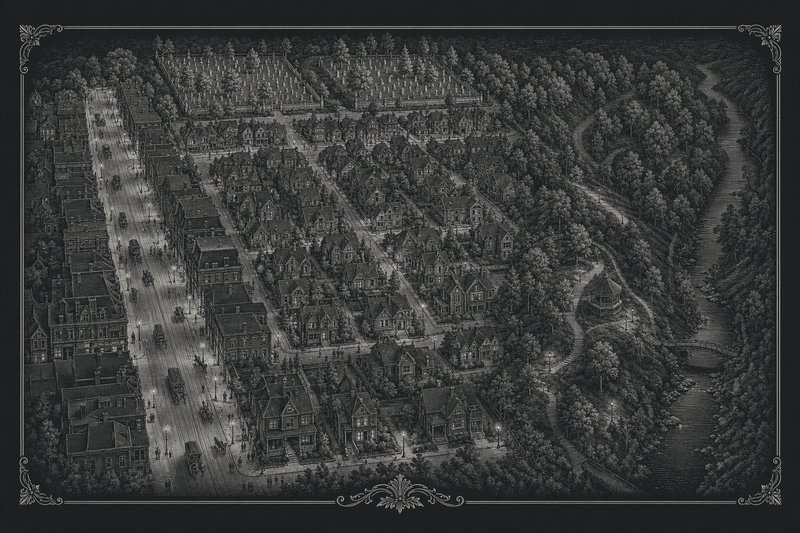
Parliament Street to the Don
The heritage districts on one plan
- Cabbagetown-Metcalfe and Cabbagetown North: east of Parliament Street, north of Carlton, to the cemeteries and the valley
- Cabbagetown South: Carlton to Gerrard, Parliament to Bayview Avenue
- Cabbagetown Northwest: Sherbourne to Parliament, Carlton to Wellesley
- Cabbagetown Southwest: Sherbourne to Parliament, Carlton to Dundas
Approximate and not to scale. The dashed areas show roughly where each district lies; the exact lines, lot by lot, are on the City of Toronto’s district maps. Streets drawn from OpenStreetMap data (© OpenStreetMap contributors).
Where is Cabbagetown? On the map it is easy: just east of downtown Toronto, where Parliament Street runs north from the lake and the city stops at the edge of the Don Valley. Where is Cabbagetown in Toronto, exactly, street by street? That is harder, and the reason is worth knowing before you start walking.
Why nobody agrees on the lines
Cabbagetown has never been a legally defined place name, and it was never surveyed. The point is made by the local historian George Rust-D’Eye and repeated in a City of Toronto heritage plan, which adds that where Cabbagetown is, or was, has been argued over even by people who lived there at the same time.
The disagreement has a history. For most of the nineteenth century and into the twentieth, the name belonged to the area south of Gerrard Street, north of Queen Street between Parliament and the Don River. The Canadian Encyclopedia still gives boundaries of that kind: the Don River on the east, Parliament Street on the west, Gerrard Street on the north and Queen Street on the south. Most of those streets were cleared for Regent Park from the late 1940s, and the name moved north onto the Victorian streets that had been known as Don Vale. That move is the subject of the page on why it is called Cabbagetown.
So any single answer is a choice. The one used in this guide follows current everyday usage and the City’s heritage districts.
The usual answer: Parliament to the Don
In everyday use today, Cabbagetown means the Victorian residential streets east of Parliament Street, running east to the Don Valley and Riverdale Park, and from Gerrard Street East in the south up to the Rosedale Valley and the two old cemeteries, St. James and the Necropolis, in the north. Carlton, Winchester, Wellesley, Sumach, Sackville, Metcalfe and Spruce are its core streets.
Parliament Street itself is the main street, where the shops and restaurants are. Its west side belongs, in heritage terms, to two further districts that run west to Sherbourne Street, so many people now count those blocks as Cabbagetown too.
If you want a single sentence: Cabbagetown is east of downtown, between Parliament Street and the Don Valley, north of Gerrard.
The five heritage conservation districts
The clearest lines on the map are the City’s five heritage conservation districts, each with Cabbagetown in its name. The plan above shows them approximately; the City’s own maps show them lot by lot.
The oldest two sit east of Parliament and north of Carlton Street. City Council designated the Cabbagetown-Metcalfe Area Heritage Conservation District in 2002 and Cabbagetown North in 2004, after studies in which residents researched the history of hundreds of properties. Between them they take in the streets most people picture when they hear the name, from Metcalfe and Sackville to the edge of the cemeteries.
Cabbagetown South followed in 2005. Its plan describes it running from the rear of the buildings on Parliament Street east to Bayview Avenue, and from the south side of Carlton Street down to Gerrard Street East, taking in the edges of Wellesley Park, the Necropolis and Riverdale Park along the way. The plan notes that, together, these three districts cover the area east of Parliament Street from Bloor Street East and the Don River south to Gerrard Street East.
West of Parliament, the Cabbagetown Northwest plan was prepared in 2007. It covers the blocks from the rear of the properties on the west side of Parliament Street to the properties on the east side of Sherbourne Street, and from Carlton Street north to the south side of Wellesley Street East, with the area between Bleecker Street and Ontario Street left out.
The last piece, Cabbagetown Southwest, was adopted by City Council in February 2024 and approved by the Ontario Land Tribunal that December. It is generally bounded by Sherbourne Street on the west, Carlton Street on the north, Parliament Street on the east and Dundas Street East on the south, with extensions along Seaton, Ontario and Berkeley Streets.
The gaps in the map are telling. North of Wellesley Street East, west of Parliament, almost all the Victorian houses were demolished for St. James Town, which is why the Northwest district stops at Wellesley. South of Gerrard, east of Parliament, the same happened for Regent Park.
How to tell you have arrived
Without a sign at the edge, the streets themselves are the best boundary markers. The City’s Cabbagetown South plan lists what people who know the neighbourhood recognize in it: narrow houses standing cheek by jowl in almost unbroken streetscapes; almost no garages, front-yard parking or wide driveways; picturesque back lanes; small front and back yards, many of them carefully gardened; houses set close to the sidewalk; and large trees that in places close over the street in a complete canopy.
The contrast is sharpest at the edges. Cross Gerrard to the south, or walk north of Wellesley west of Parliament, and the scale changes abruptly, from two-and-a-half-storey rows to the apartment blocks of Regent Park and St. James Town. East of Sumach, the ground drops away towards Riverdale Park and the Don Valley. When the houses get narrower, closer together and older, and the trees get bigger, you are in Cabbagetown.
Neighbours
Knowing what surrounds Cabbagetown helps with finding it. To the south, across Gerrard Street, is Regent Park, rebuilt in stages since a revitalization plan began in 2005. To the northwest, the towers of St. James Town rise north of Wellesley Street. To the east, across the Don Valley, is Riverdale, with the old Don Jail of 1865 visible from Riverdale Park West. To the west, past Sherbourne Street, lie Allan Gardens and the Garden District.
For statistics, the City folds the neighbourhood into a larger unit called Cabbagetown-South St. James Town, which includes high-rise blocks that no Victorian builder would recognize. Figures quoted for “Cabbagetown” often come from that larger area, so read them with care.
One aside for map lovers: the grid here is older than most of the houses. It continues the survey of the Town of York begun in 1793, so almost every corner here is a right angle. The one real curve in the south of the district is where Spruce Street bends into River Street.
Getting there
The neighbourhood is well served by the TTC, though its routes are diverted often for construction.
By streetcar, the 506 Carlton is the route through the middle of the neighbourhood. It runs along Carlton Street and Gerrard Street, jogging along Parliament Street between the two, so it passes both the shopping street and the heart of the heritage districts. The 505 Dundas runs a few blocks further south, along the edge of Regent Park.
By bus, the 65 Parliament runs the length of Parliament Street and connects with the subway at Castle Frank station, on Line 2, which is the closest station to the neighbourhood, across the Rosedale Valley at its northern end. The 75 Sherbourne and the 94 Wellesley serve the western and northern edges.
Check ttc.ca for diversions on the day. Parking is tight and mostly on-street under permit rules, which the living in Cabbagetown page explains.
For a route through it, the walk map and the places guide take it from here.
Questions
Where is Cabbagetown in Toronto?
Just east of downtown. In everyday use the name covers the Victorian streets east of Parliament Street, running to the Don Valley, from Gerrard Street East north towards the Rosedale Valley and the St. James and Necropolis cemeteries. Two heritage districts extend it west of Parliament as far as Sherbourne Street.
What are Cabbagetown's boundaries?
There are no legal boundaries, because the name has never been formally defined or surveyed. The City's heritage districts give the clearest lines: the three original ones cover the area east of Parliament Street from Bloor Street East and the Don River south to Gerrard Street East, and two newer ones run from Parliament west to Sherbourne, between Wellesley and Dundas.
Is Regent Park part of Cabbagetown?
Historically, yes: Regent Park, south of Gerrard Street, was built from the late 1940s on the site of the original Cabbagetown. Today the two are usually treated as separate neighbourhoods, with Gerrard Street as the line between them. The history of the name explains how that happened.
Which subway station is closest to Cabbagetown?
Castle Frank station on Line 2 is the nearest, at the north end of the neighbourhood across the Rosedale Valley, and the 65 Parliament bus connects it with Parliament Street. Check ttc.ca for current routes and diversions before you travel.
Which streetcar goes to Cabbagetown?
The 506 Carlton streetcar runs east–west through the neighbourhood along Carlton Street and Gerrard Street, jogging along Parliament between them, and the 505 Dundas passes to the south. The route is frequently diverted for track and construction work, so check ttc.ca on the day. Buses on Parliament, Sherbourne and Wellesley also serve the area.
Is Allan Gardens in Cabbagetown?
Not strictly. Allan Gardens lies west of Sherbourne Street, just outside the heritage districts that carry the Cabbagetown name, but it is only a short walk from the western edge and makes a natural start for a visit. The Allan Gardens page has the details.
What neighbourhoods border Cabbagetown?
Regent Park lies to the south across Gerrard Street, St. James Town to the northwest, with its towers north of Wellesley Street, and the Riverdale area to the east across the Don Valley. To the west, past Sherbourne Street, are Allan Gardens and the Garden District.