HomeHistory
Cabbagetown History and Facts, from Don Vale to the Heritage Districts
Two hundred acres granted to a boy in 1795, a grid of streets laid out before most of the houses, and a building boom whose houses still line almost every street.
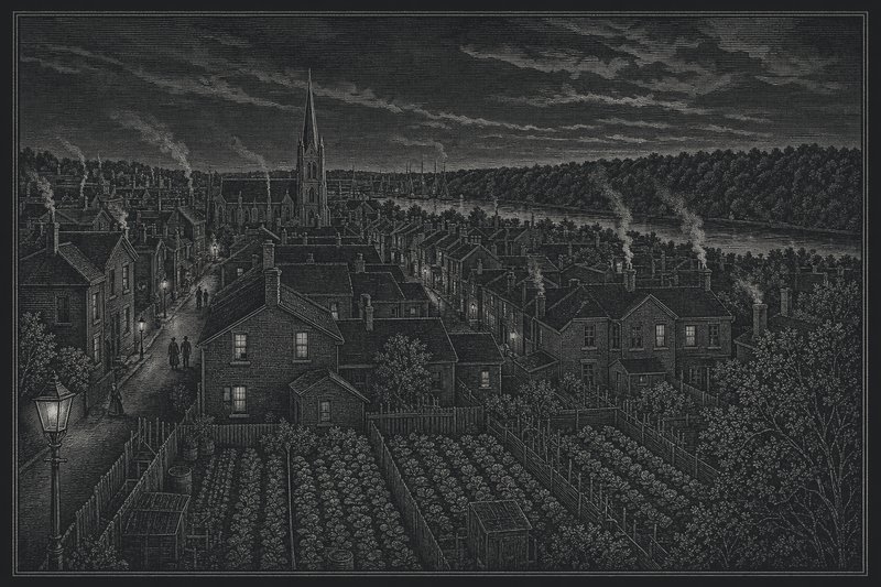
Most neighbourhoods grow and then get a plan. Cabbagetown got the plan first. The grid its streets follow is an extension of the one laid out by the Simcoe administration soon after the founding of the Town of York in 1793, which is why nearly every street here runs north–south or east–west and meets its neighbours at right angles.
What follows is the history of the place in the order it happened, with the facts that City heritage planners and local researchers have pinned down. For the separate story of the name, see why it is called Cabbagetown.
A park lot and the Liberties
In 1795 Lieutenant Governor John Graves Simcoe received a Crown grant of two hundred acres for his young son, Francis Graves Simcoe. The land lay west of the Don River as far as Parliament Street, and ran from the line of present-day Bloor Street south to Carlton Street. It was one of two park lots east of Parliament, set aside as a government reserve while the Town of York grew westward along the lake.
When the City of Toronto was incorporated in 1834, its limits stopped well south of here. The land up to the first concession line, Bloor Street, was held back for later annexation and known as the Liberties. A topographical plan drawn by James Kane in 1842 shows the area cleared of its original trees, with streets pencilled in but no buildings yet.
By the 1850s most of the street layout was complete, and the first houses followed.
The building boom of the 1870s and 1880s
The houses you see today are mostly the product of two busy decades. Development began in the 1850s, but significant building came in the 1870s and 1880s and continued into the early twentieth century. That period set the late Victorian character the neighbourhood is known for.
The houses were largely builder-constructed, based on pattern-book designs rather than architects’ drawings, and put up close together, usually in pairs or rows of identical houses. Here is the detail that surprises most visitors: many of them are not brick houses at all in the structural sense. The heritage plan for Cabbagetown South describes them as pine balloon-frame buildings with a protective, decorative brick front that carries no load. The sides and back are often stucco or siding. Look down a laneway and you can see it.
The styles varied more than the construction did. Bay-and-gable houses dominate, with Second Empire, Gothic, Romanesque and Georgian examples mixed in, and a handful of Queen Anne fronts. The house-style spotter sorts them out on the sidewalk.
A hospital on Gerrard Street
For almost seventy years the most important building in the southern part of the district was a hospital. The Toronto General Hospital’s main building, designed by the architect William Hay, stood on the north side of Gerrard Street East between Sackville and Sumach from 1856 until 1922. It was a four-storey building with five towers along a 175-foot front, the central one a hundred feet high.
Around it grew a small medical quarter: a fever hospital, the Mercer Eye and Ear Infirmary, a dispensary for women, the Burnside Lying-In Hospital for maternity cases, and, by 1881, a school of nursing, only the second in Canada. Two buildings from that world survive, both now homes: the Trinity College Medical School at 41 Spruce Street, built in 1871, and the Ontario Medical College for Women at 289 Sumach Street, from 1890.
When the hospital went, the land was divided up in the 1920s. Gifford Street and Nasmith Avenue were laid out across it, which is why a walk down those two streets suddenly swaps Victorian gables for plainer, wider 1920s houses with deep porches and driveways.
Who lived here
The early twentieth-century neighbourhood was less uniform than the “slum” label that came later suggests. The heritage plan lists, among residents, store managers and carpenters, businesspeople, accountants, clerks, doctors, salespeople, cutters, church ministers, artists and butchers, as well as nurses, messengers, brewery, gas and soap workers, stevedores and railway employees. Labourers and prosperous families shared the same streets.
Spruce Court belongs to this chapter too. The Toronto Housing Company built it between 1913 and 1926 to designs by Eden Smith, one of the leading architects of the day, and laid it out on English Garden City lines, with homes facing shared gardens and grassy courtyards. It was housing reform in brick and stucco, a generation before Regent Park.
West of Parliament: churches, a bank and a skating rink
The blocks between Parliament and Sherbourne Streets developed on the same pattern, and the City’s heritage plan for the Northwest district records a handful of buildings that anchor them. St. Peter’s Church is designated under the Ontario Heritage Act; its rectory at 190 Carlton Street was built in 1905 to designs by Gordon & Helliwell. On the west side of Ontario Street, north of Carlton, stands the building of the First Church of Christian Association, also from 1905, by the architect F. J. Bird.
On the south-west corner of Carlton and Parliament is a former Canadian Bank of Commerce branch, built in 1905 by Darling & Pearson. The architectural historian Patricia McHugh described it as “auspicious, Classical Revival”, with heavy Doric columns around a deep entrance and, above it, a domestic Queen Anne bay window; small branch banks like it often had apartments on the upper floor. Further west, the house at 437 Sherbourne Street, built in 1876–77 by Harper & Sons, carries a Toronto Historical Board plaque as the home of the Reverend Alexander Sutherland, and the Ernescliffe apartment buildings of 1913–14, by Redmond & Beggs, add a Classical Revival note with their Ionic pilasters.
Some of the local detail is lost from view entirely. For a time in the 1880s and 1890s, the area just south-east of Prospect and Ontario Streets was home to the Prospect Park Club and its skating rink. Ontario Street was once called McMahon, and Prospect Street was Nassau Street. Ontario Street also marked the boundary between two city wards, St. Thomas and St. David.
South of Carlton, the Cabbagetown South plan singles out other buildings on the City’s heritage inventory: the Gerrard Street Pharmacy at 434–436 Gerrard Street East, later the Avion Hotel, from 1890–91; the Richard Stapells House at 54 Spruce Street, from 1882; and the Spruce Court apartments of 1913.
Decline, and two clearances
After the First World War the district’s fortunes turned. The mix of residents changed, houses were divided and the building stock declined, a slide that lasted into the 1960s. This is the Cabbagetown of Hugh Garner’s novel, and the reputation that came with it.
Two large clearances then reshaped the edges. From the late 1940s, much of the original Cabbagetown south of Gerrard was demolished for Regent Park; families began moving into Regent Park North in 1949, and construction continued into the 1950s. Later, almost all of the Victorian houses north of Wellesley Street East were demolished to build St. James Town. The heritage plans say plainly that these clearances are why the districts stop where they do.
A side note that is easy to miss from street level: the view east from Riverdale Park West takes in the old Don Jail of 1865 on the far side of the valley, a reminder of how close this “village” always was to the institutions of the city.
Restoration and the heritage districts
From the 1960s a new generation began moving in and repairing the houses north of Gerrard. By the 1970s urban renewal was reshaping older downtown neighbourhoods across Toronto, and Cabbagetown had what the heritage plan calls a “sense of place”: pedestrian-scale streets, back lanes and a recognizable architectural tradition. Restoration, not redevelopment, won out here.
The 2005 heritage plan still recommends the back lanes for strolling, and for looking at the extensive renovations to the rear of many of the homes, which is where the scale of that restoration shows most clearly. Residents organized to protect the result. The Cabbagetown Preservation Association was founded in 1987. Its volunteers built an inventory of every property, with a photograph of each building, construction dates, ownership records and a survey of trees on private land, and that inventory became the principal evidence for the heritage districts.
The City designated them one after another. The Cabbagetown-Metcalfe Area Heritage Conservation District came first, by By-law 110-2002. Cabbagetown North followed in 2004, by By-law 259-2004, and Cabbagetown South in 2005, by By-law 887-2005, with no appeals. The Cabbagetown Northwest plan was prepared in 2007 for the blocks between Parliament and Sherbourne. Last came Cabbagetown Southwest: adopted by City Council on 6 February 2024 and approved by the Ontario Land Tribunal on 5 December 2024.
Not everything is covered. The Cabbagetown Preservation Association points out that Parliament Street itself, the neighbourhood’s main street, is not protected, and it faces development pressure. Anyone who wants to see what the districts protect should take the heritage walk through their streets.
A few facts worth knowing
- The Cabbagetown South district alone contains 460 properties, and the area has upwards of 200 trees of more than thirty species on its streets and front yards, according to the 2005 plan.
- The only curve in that district’s grid is where Spruce Street bends into River Street.
- Some houses south of Spruce Street have narrow driveways from the 1920s, sized for the cars of the day.
- The Toronto Necropolis opened on the valley rim in 1850; St. James Cemetery lies along Parliament Street at the north end. Both are covered on the cemeteries page.
- Part of Riverdale Park West became one of Toronto’s first zoos in 1899. The zoo moved away in 1974, and its site is now Riverdale Farm.
Look out, too, for the oval plaques beside some front doors. The Toronto Historical Board issued them in 1984, for the city’s 150th birthday, to owners of listed and designated houses, though, as the Northwest plan notes, a plaque on its own protects nothing.
Questions
How old is Cabbagetown?
The streets were laid out from the 1840s and mostly complete by the 1850s, when the first houses went up. The big building period came in the 1870s and 1880s, and most of the houses standing today date from those two decades, with development continuing to the early 1900s. The land itself was granted by the Crown in 1795.
Who first owned the land?
In 1795 Lieutenant Governor John Graves Simcoe received a Crown grant of two hundred acres in the name of his young son, Francis. The grant ran west from the Don River to Parliament Street and south from today's Bloor Street to Carlton Street, one of the park lots set aside east of Parliament.
Are the houses really brick?
Mostly not all the way through. The City's heritage plan for Cabbagetown South notes that many houses that look brick are pine balloon-frame structures with a decorative, non-supporting brick front facing the street. Side and rear walls are often stucco or siding. The house-style guide explains what to look for.
What happened to the original Cabbagetown?
Much of it, south of Gerrard Street, was demolished in the late 1940s for the Regent Park housing project; the first families moved into Regent Park North in 1949. North of Wellesley Street, most of the Victorian houses were later cleared for St. James Town. The streets in between survived, and they are what the name means today.
What was the Toronto General Hospital doing in Cabbagetown?
The hospital's main building, designed by William Hay, stood on the north side of Gerrard Street East between Sackville and Sumach from 1856 until 1922. Around it grew a fever hospital, an eye and ear infirmary, a maternity hospital and, by 1881, a school of nursing. Two related buildings survive as homes, at 41 Spruce Street and 289 Sumach Street.
When did Cabbagetown become a heritage district?
In stages. City Council designated Cabbagetown-Metcalfe in 2002, Cabbagetown North in 2004 and Cabbagetown South in 2005, followed by Cabbagetown Northwest later in the decade. Cabbagetown Southwest was adopted by Council in February 2024 and approved by the Ontario Land Tribunal that December. The boundaries page maps all five.
What is Spruce Court?
A housing development on Spruce Street built by the Toronto Housing Company between 1913 and 1926 and designed by the architect Eden Smith. It follows the English Garden City idea, with homes opening onto shared gardens and grassy courtyards, and it is one of the individually designated heritage properties in Cabbagetown South.
Who lived in Cabbagetown in the early 1900s?
A wide mix. The City's heritage plan lists store managers, carpenters, accountants, clerks, doctors, cutters, ministers, artists and butchers, alongside nurses, messengers, brewery, gas and soap workers, stevedores and railway employees. Labourers and more prosperous families lived on the same streets, in houses of very different size.
Who looks after Cabbagetown's heritage now?
The City of Toronto's heritage planners administer the district plans, with a local advisory committee of residents. The Cabbagetown Preservation Association, founded in 1987, carried out much of the research behind the designations, including an inventory with a photograph of every building and a survey of trees on private land.